
North Vancouver
Where City Streets Meet Mountain Ground
Across two independently governed municipalities, waterfront urbanism, forest-edge neighbourhoods and rising terrain create property decisions shaped as much by access and site as by housing type.
Place at a glance
One market name. Two municipal realities.
North Vancouver spans the City of North Vancouver and the District of North Vancouver. The compact City concentrates urban life along the waterfront and Lonsdale corridor; the larger District extends through valleys, hillsides, coves and mountain-edge communities. Confirming the municipality is the first step in any property or planning review.
Waterfront and Lonsdale rise north toward valley and mountain communities. This is editorial context, not a legal-boundary or buildability map.
Geographic intelligence
Elevation changes the property conversation.
Lower Lonsdale begins at the harbour; the street grid then climbs toward established hillside neighbourhoods. Farther east and west, creeks, ravines, forest edges and bridge approaches create distinct conditions. A short map distance can conceal meaningful differences in grade, winter exposure, access and daily mobility.
Urban grade
Walkability and views can change quickly along rising streets.
Creeks + ravines
Natural systems require property-specific environmental and drainage review.
Bridge access
Route choice depends on neighbourhood, direction and time of day.
Forest edge
Trees, shade, weather and interface conditions shape many District sites.
Architectural intelligence
A spectrum from concrete waterfront to post-and-beam hillside.
Lonsdale urbanism
Concrete and wood-frame apartments, mixed-use buildings and newer towers form a layered corridor whose age, construction, exposure and strata history matter building by building.
West Coast residential legacy
Post-war and post-and-beam homes often use broad glazing, expressed structure and landscape connection, though condition and architectural integrity vary by property.
Hillside houses
Split levels, stepped foundations, decks and view-oriented rooms frequently respond to rising ground rather than a flat suburban lot.
Village multifamily
Lynn Valley, Edgemont and other centres combine townhomes and apartments with established detached streets at a smaller scale than Lonsdale.
Contemporary infill
Duplex, multiplex, townhouse and replacement-home forms are changing selected blocks, with different rules and processes in the City and District.
Site + physical context
Urban convenience does not erase North Shore conditions.
These prompts organize due diligence; they are not engineering, environmental or legal conclusions.
Municipality
Confirm City or District before reviewing policy, zoning, taxes or services.
Grade
Assess entry, stairs, driveway, retaining and usable outdoor ground.
Water
Review drainage, creek and slope conditions with qualified professionals.
Orientation
Elevation, trees and nearby buildings shape light, outlook and privacy.
Access
Bridge, SeaBus, bus and highway usefulness varies by exact location.
Building age
Construction era and renewal history are material for both houses and strata.
Servicing
Site infrastructure and municipal requirements need current confirmation.
Approval context
Potential varies by site, zoning, policy, servicing, physical conditions and municipal approval.
Neighbourhood structure
Seven distinct North Vancouver settings.
These are established local areas presented as editorial orientation. Profiles remain on this page where no separate verified destination is used.
Neighbourhood profiles
Lower Lonsdale
The Shipyards, SeaBus and waterfront public realm anchor North Vancouver’s strongest concentration of towers, mixed-use buildings and walkable urban life.
Central Lonsdale
Shops, services, civic uses and buildings from several eras line a corridor where block, elevation and construction type can change quickly.
Upper Lonsdale
Residential streets rise above the corridor into a mix of detached, townhouse and smaller multifamily conditions; municipal boundaries require address-level confirmation.
Edgemont
A compact village core sits within mature District streets, linking daily amenities with detached homes, renovations and selective attached housing.
Lynn Valley
A forest-edge community centre combines established homes with townhomes and newer multifamily housing near recreation and mountain access.
Deep Cove
Indian Arm, steep wooded ground and a small village create a marine setting where access, elevation, outlook and exposure vary sharply.
Canyon Heights
Established hillside streets near the Capilano corridor place lot grade, mature landscape and the relationship between house and ground at the centre of review.
Planning + development context
Begin with the correct municipality.
The City and District maintain separate official plans, zoning bylaws and development processes. Urban growth around Lonsdale, village-centre change and evolving housing policy provide area context, but they do not establish what may be approved on a particular parcel.
Potential varies by site, zoning, policy, servicing, physical conditions and municipal approval. Confirm current requirements with the applicable municipality and qualified professionals.
Parham-owned market evidence
Selected North Vancouver Sales
A restrained record of represented sales, presented as historical portfolio evidence—not current inventory or market statistics.
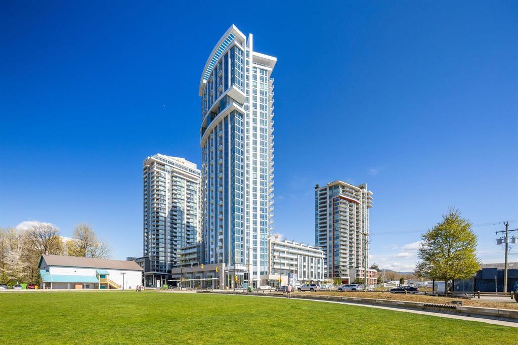
805 1500 Fern Street
North Vancouver
1 Bed · 1 Bath · 617 sq ft
$679,900
View propertyParham Baghaie Personal Real Estate Corporation
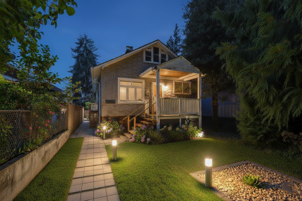
535 W 15Th Street
Central Lonsdale
2 Baths · 2,020 sq ft
$1,395,000
View propertyParham Baghaie Personal Real Estate Corporation
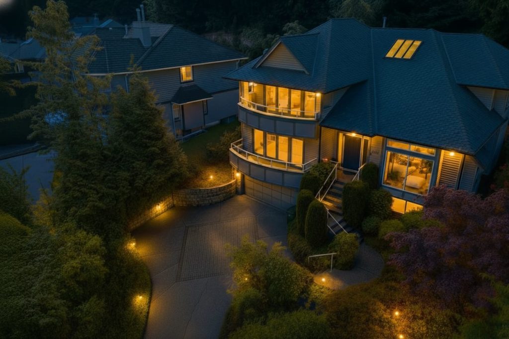
3965 Braemar Place
North Vancouver
6 Beds · 4 Baths · 4,261 sq ft
$2,599,000
View propertyParham Baghaie Personal Real Estate Corporation
North Vancouver advisory
Read the municipality, site and building together.
For buying, selling or evaluating a property, Parham connects architectural judgment with terrain, neighbourhood and municipal context.
Private ConsultationAbout ParhamPrepared and maintained by Parham Baghaie PREC* · Last reviewed August 2026