
Burnaby
A City of Centres, Ridges and Changing Scale
Four major town centres, rapid-transit corridors and established residential districts place towers, low-rise housing and detached streets within one varied urban structure.
Place at a glance
Burnaby is polycentric, not one downtown.
Metrotown, Brentwood, Lougheed and Edmonds organize growth across the city, while ridges, lakes, parks, employment lands and post-war neighbourhoods create substantial space between them. Property context therefore depends on which centre, corridor or residential fabric an address belongs to.
Four centres are connected by transit and roads, with parks, employment lands and neighbourhoods between them. This is not a parcel or entitlement map.
Geographic + urban intelligence
Distance from a centre is only the first measure.
Burnaby’s ridges and valleys influence outlook, walking routes and street connections. Rail lines, highways and large parks can shorten or interrupt the apparent distance between places. Near a town centre, the transition from towers to low-rise or detached housing may occur over only a few blocks.
Ridge + outlook
Elevation affects views, exposure and pedestrian effort.
Transit access
Station proximity should be tested by the actual walking route.
Urban transition
Tower, low-rise and detached conditions often meet abruptly.
Edges
Parks, industry, highways and rail shape connectivity and noise.
Architectural intelligence
Building type changes with the city’s urban rhythm.
Town-centre towers
Concrete high-rises and mixed-use podiums concentrate near rapid transit, where tower spacing, suite exposure, building operations and strata history are decisive.
Post-war detached fabric
Many established streets contain modest houses, renovations and newer replacements on regular lots, with block character shaped by era and landscape.
Low-rise apartments
Wood-frame and older concrete buildings provide a different scale near centres and corridors; construction era and renewal history deserve close review.
Townhouse communities
Attached housing bridges tower and detached contexts, with site planning, grade, private outdoor space and strata governance influencing quality.
Contemporary infill
New housing forms are entering established areas selectively, but policy direction must not be read as a property-specific approval.
Property context
Read the building, block and centre together.
These prompts frame due diligence and are not engineering, legal, strata or planning conclusions.
Centre
Identify the town-centre or neighbourhood structure shaping the address.
Transit route
Test station access, grade, crossings and daily walking conditions.
Building era
Review construction type, renewal history and operational context.
Exposure
Consider outlook, sunlight, traffic, rail and neighbouring form.
Street transition
Understand how nearby scale and land use change by block.
Site conditions
Grade, drainage, trees and servicing remain property-specific.
Strata
For attached housing, review records, financials, bylaws and insurance.
Approval context
Potential varies by site, zoning, policy, servicing, physical conditions and municipal approval.
Subarea structure
Five Burnaby settings with different property logic.
These established local areas are presented as editorial orientation. Profiles remain on this page where no separate verified destination is used.
Area profiles
Metrotown
Burnaby’s largest regional centre combines major retail, civic and employment uses with generations of concrete towers, apartments and nearby established streets.
Brentwood
New mixed-use towers and public spaces sit beside earlier high-rise, low-rise and detached housing, making construction era and immediate context especially visible.
Lougheed
A major transit interchange anchors high-rise growth near the Coquitlam boundary while established apartment and residential areas extend around it.
Edmonds
SkyTrain access, newer multifamily housing, older apartments, townhomes and detached pockets produce a more varied scale than a single tower-centre label suggests.
Burnaby Heights
A ridge-top commercial street and established residential grid create a walkable, lower-scale setting distinct from Burnaby’s principal tower centres.
Planning + development context
Growth is concentrated, but outcomes remain site-specific.
Burnaby’s town-centre planning and transit-oriented growth explain where substantial change is occurring. They do not guarantee density, timing, assembly, redevelopment or approval for an individual property, and established residential areas carry their own policy and physical context.
Potential varies by site, zoning, policy, servicing, physical conditions and municipal approval. Confirm current information with the City of Burnaby and qualified professionals.
Parham-owned market evidence
Selected Burnaby Sale
A single relevant represented sale, shown as historical portfolio evidence—not current inventory or a market statistic.
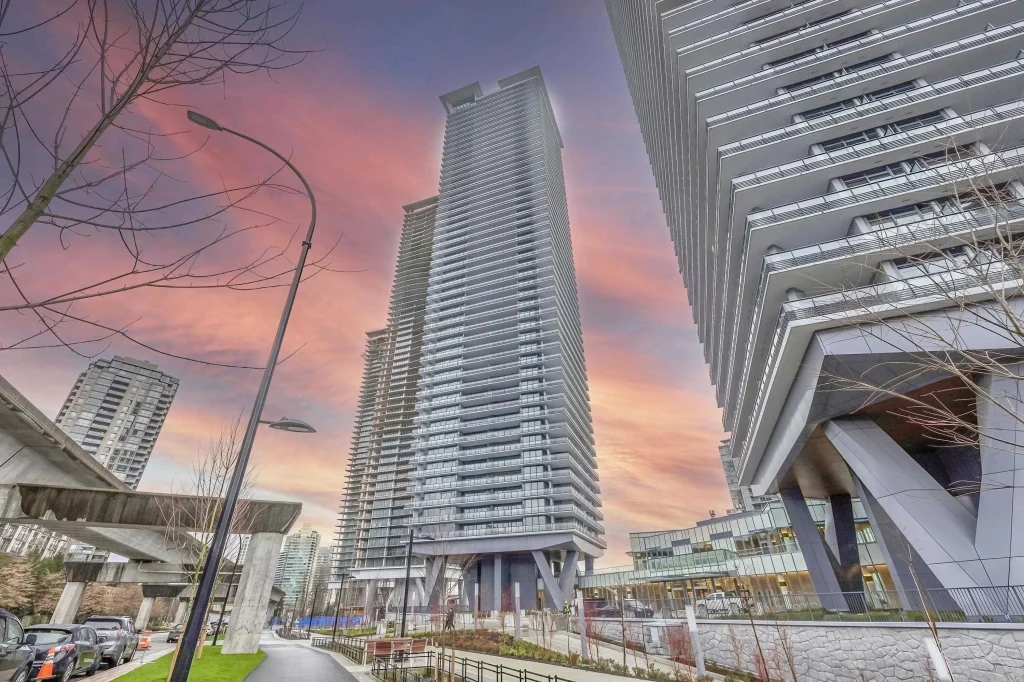
4106-4720 Lougheed Highway
Burnaby North
1 Bed · 1 Bath · 537 sq ft
$619,900
View propertyParham Baghaie Personal Real Estate Corporation
Burnaby advisory
Understand the centre, building and block.
Parham connects architecture, urban structure, planning context and market positioning for a more complete property decision.
Private ConsultationAbout ParhamPrepared and maintained by Parham Baghaie PREC* · Last reviewed August 2026